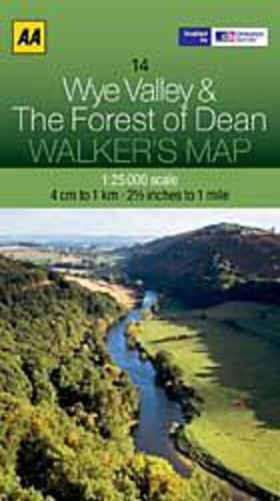
AA PUBLISHING WANDELKAART 14 WYE VALLEY & THE FOREST OF DEAN (9780749573362)
OMSCHRIJVING
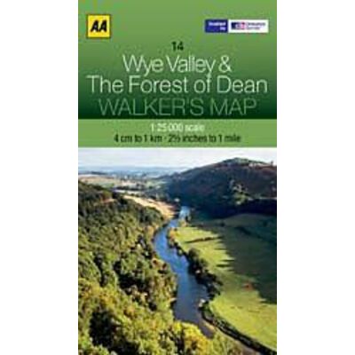
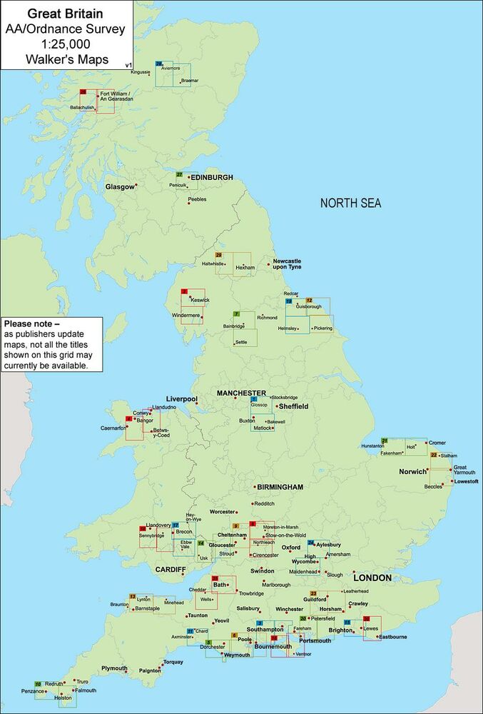
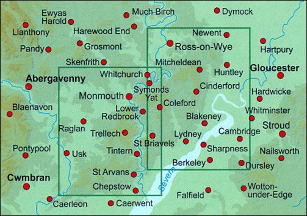
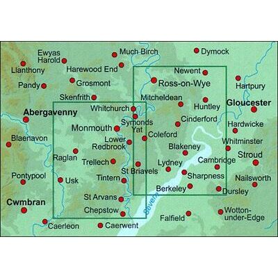
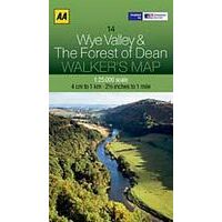
Wye Valley and The Forest of Dean at 1:25,000 in a series of Walker’s Maps published by the AA with the cartography from the Ordnance Survey’s Explorer series. The map is double-sided and coverage includes Ross-on-Wye, Monmouth, Whitchurch, Raglan, Usk, Chepstow, Berkeley, etc.
Maps in the AA Walker’s series are identical to the OS Explorer maps and provide plenty of recreational and tourist information, indicating in England and Wales the traditional public rights of way paths, including bridleways and byways restricted or open to motorized traffic. Also shown are other routes with public access, including permissive footpaths and bridleways. For Scotland, where different access rights apply, the maps provide an additional note explaining the regulations. Special marking indicates National Trails and Recreational Routes and for cyclists the maps show traffic-free routes and the National Cycle Network.
A wide range of symbols highlights locations of special tourist interest: camping and caravanning sites, youth hostels, information offices and visitors’ centres, parking and picnicking places, historic buildings (indicating where appropriate National Trust, English Heritage, Historic Scotland or Cadw), sites for various recreational pursuits, country pubs, public toilets, etc.
The maps provide detailed presentation of the topography with contours at 5 or 10m intervals, numerous spot heights and colouring and/or graphics for different types of vegetation. Additional colouring shows access land, including areas managed by the National Trust, Forestry Commission and Woodland Trust. All the standard information expected of high quality survey mapping at this scale is included: finely graded road network, railway lines with stations, cuttings or embankments, individual isolated buildings, etc.
For GPS users the British National Grid is drawn at 1km intervals.
Bekijk alle Europa
OMSCHRIJVING
Maps in the AA Walker’s series are identical to the OS Explorer maps and provide plenty of recreational and tourist information, indicating in England and Wales the traditional public rights of way paths, including bridleways and byways restricted or open to motorized traffic. Also shown are other routes with public access, including permissive footpaths and bridleways. For Scotland, where different access rights apply, the maps provide an additional note explaining the regulations. Special marking indicates National Trails and Recreational Routes and for cyclists the maps show traffic-free routes and the National Cycle Network.
A wide range of symbols highlights locations of special tourist interest: camping and caravanning sites, youth hostels, information offices and visitors’ centres, parking and picnicking places, historic buildings (indicating where appropriate National Trust, English Heritage, Historic Scotland or Cadw), sites for various recreational pursuits, country pubs, public toilets, etc.
The maps provide detailed presentation of the topography with contours at 5 or 10m intervals, numerous spot heights and colouring and/or graphics for different types of vegetation. Additional colouring shows access land, including areas managed by the National Trust, Forestry Commission and Woodland Trust. All the standard information expected of high quality survey mapping at this scale is included: finely graded road network, railway lines with stations, cuttings or embankments, individual isolated buildings, etc.
For GPS users the British National Grid is drawn at 1km intervals.
Bekijk alle Europa
PRODUCTINFORMATIE AA PUBLISHING WANDELKAART 14 WYE VALLEY & THE FOREST OF DEAN
PRODUCTINFORMATIE AA PUBLISHING WANDELKAART 14 WYE VALLEY & THE FOREST OF DEAN
HET MERK AA PUBLISHING

De Automobile Association is de Engelse tegenhanger van de ANWB en geeft sinds 1910 autogidsen, atlassen en drivingguides uit. Recentelijk komen daar steeds meer wandel- en fietsgidsen bij.
HET MERK AA PUBLISHING

De Automobile Association is de Engelse tegenhanger van de ANWB en geeft sinds 1910 autogidsen, atlassen en drivingguides uit. Recentelijk komen daar steeds meer wandel- en fietsgidsen bij.
GARANTIE
Of u het product online via de webshop of in onze fysieke winkel gekocht heeft, de garantie is voor Zwerfkei hetzelfde. De garantietermijn kan per product en merk verschillen, van één jaar tot de volledige levensduur van het product. Garantie geldt in principe op alle materiaal- en/of fabricagefouten, en niet op defecten als gevolg van slijtage of verkeerd gebruik. In het geval van garantie wordt het defecte product vervangen, vergoed of hersteld door de fabrikant/importeur of door een professionele en gespecialiseerde reparateur.
Zwerfkei verzorgt de begeleiding en de afhandeling van garantiegevallen voor u. Wij bieden het product na beoordeling ter reparatie aan bij de fabrikant/importeur of één van hun professionele servicediensten. Wij onderhouden goede contacten met onze servicediensten en samen zorgen wij ervoor dat elk defect zo snel mogelijk opgelost wordt.
AA PUBLISHING WANDELKAART 14 WYE VALLEY & THE FOREST OF DEAN KOPEN?
KEUZEHULP
OPENINGSTIJDEN
| Ma | 13:00 - 18:00 uur |
| Di | 09:00 - 18:00 uur |
| Wo | 09:00 - 18:00 uur |
| Do | 09:00 - 18:00 uur |
| Vr | 09:00 - 21:00 uur |
| Za | 09:00 - 17:00 uur |
| Zo | gesloten |
Volgende week:
| Ma | gesloten |
| Di | 09:00 - 18:00 uur |
| Wo | 09:00 - 18:00 uur |
| Do | 09:00 - 18:00 uur |
| Vr | 09:00 - 21:00 uur |
| Za | 09:00 - 17:00 uur |
| Zo | gesloten |
3446 CR Woerden
0348-421648
ANDERE KLANTEN KOCHTEN OOK
